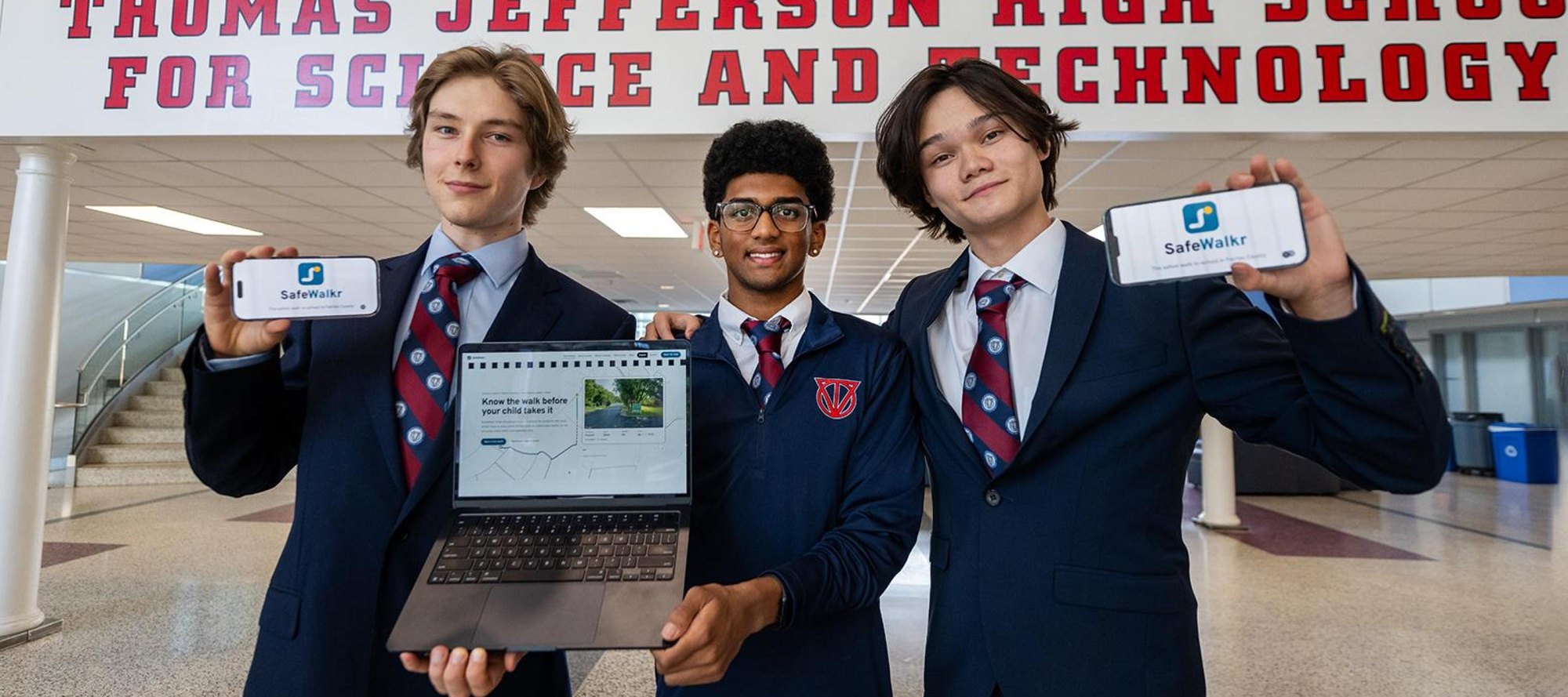
Three high school seniors launched a free app Wednesday, Oct. 7, that maps safer walking routes to school for families at Chesterbrook Elementary, Freedom Hill Elementary and Cooper Middle School.
The app, called SafeWalkr, debuted as a pilot at 14 Fairfax County Public Schools (FCPS) on National Walk and Roll to School Day. Daniil Prokofev, Ashwath Muppa and Isaac Leetyn, all seniors at Thomas Jefferson High School for Science and Technology (TJHSST), built it after Prokofev was routed along a stretch of Braddock Road with no sidewalks while running home from school. Google Maps had sent him there.
"I was fighting through shrubbery; it was getting dark, and there were so many cars in close proximity to me," Prokofev told FCPS.
That run sparked SafeWalkr.
Prokofev said standard navigation tools optimize for speed, not pedestrian safety. SafeWalkr layers Fairfax County sidewalk data, traffic volumes and Google Street View imagery to find routes that prioritize crosswalks and sidewalks over shortcuts. For two-thirds of homes in the pilot area, the safest route is not the shortest, according to the app's website.
The trio built the app during HackTJ, TJHSST's annual 24-hour coding competition, where it was crowned the winning concept. They wrote a custom algorithm in Python, JavaScript and C++ using skills from a machine learning class taught by TJHSST teacher Nicole Kim. Math teacher Sewon Yang served as the project advisor and helped secure funding.
TJHSST Principal Mike Mukai visited the team around 11 p.m. during the hackathon and introduced them to the FCPS Safe Routes to School team. Becky Gray, a Safe Routes to School specialist, worked with the students to refine the site for local families. The students also consulted FCPS Chief Technology Officer Gautam Sethi on cybersecurity standards and Chief Safety and Security Officer Brian Lambert on safety protocols.
The pilot's 14 schools were selected based on a traffic and pedestrian survey conducted during the 2025-2026 school year. Besides the three McLean-area campuses, the list includes Annandale Terrace, Bush Hill, Cardinal Forest, Lemon Road, Kings Park, Ravensworth, McNair and Mt. Eagle elementary schools; Twain Middle School; and Hayfield Secondary and Justice High School.
The launch comes a month after a September 2026 FCPS Safe Routes to Schools assessment found that kiss-and-ride congestion is the district's "most significant operational concern districtwide," as first reported by FFXnow. That report noted many parents want their children to walk but feel unsafe allowing them to do so.
The three seniors said they hope to expand SafeWalkr to all FCPS schools. Families in the walking zones of the 14 pilot schools can check routes at safewalkr.com.